You’re under pressure to excavate safely, on schedule, and in compliance. GPR gives you non-intrusive subsurface data to validate as-builts and one-call marks, detect unknowns, and quantify depth with confidence metrics. You can set exclusion zones, define hold points, and mandate daylighting where uncertainty is high. Standardized QA/QC and traceable logs support audits and reduce strike risk. But the real advantage emerges when you integrate GPR into your risk model and daily field decisions…
The Safety Case for Non-Destructive Subsurface Mapping
Even before you break ground, non-destructive subsurface mapping establishes a defensible safety baseline by identifying buried utilities, voids, and hazards without disturbing the site. You validate site conditions with reproducible data, traceable records, and survey-grade coordinates, so teams share a common operating picture. You integrate geophysical results into your Risk assessment, ranking likelihood and consequence, then prioritizing controls. You align methods with industry standards, calibrate equipment, and document quality checks to satisfy audit trails and client requirements.
With clear targets and uncertainty bands, you define exclusion zones, sequencing, and crew briefings that reinforce belonging to a competent, safety-led culture. You implement Avoidance protocols, lock in tolerance thresholds, and assign hold points for verification. By doing so, you reduce ambiguity, accelerate approvals, and protect people, assets, and schedules.
Preventing Utility Strikes and Unplanned Outages
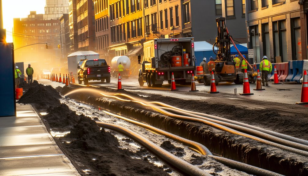
Before you excavate, prevent utility strikes and outages by integrating locate data, as-built records, and one-call responses into a single, validated utility model with positional tolerances. You’ll reduce ambiguity, enforce strike avoidance, and align your team around a common, auditable baseline.
Use GPR with depth sounding to verify burial profiles, then reconcile conflicts through standardized QA/QC.
- Define tolerance zones by utility class; require daylighting where depth sounding or GPR confidence falls below threshold.
- Coordinate lockout/tagout windows with asset owners; document contingency feeds to maintain service continuity during cutovers.
- Apply a change-control log for any deviations; re-issue stamped drawings so crews operate from the latest model.
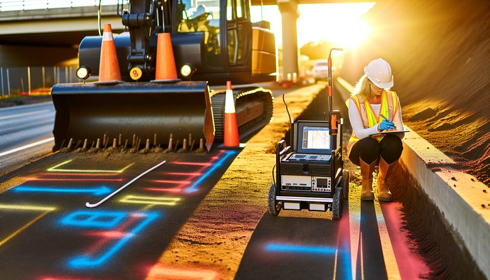
Real-Time Data for Smarter Field Decisions
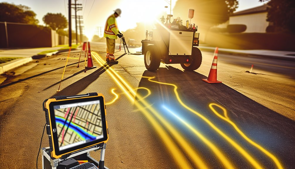
While crews move from locate to excavation, you need live telemetry to close the gap between the model and the trench. You depend on Ground Penetrating Radar with live monitoring to stream depth, amplitude, and confidence metrics as conditions change. With decision dashboards, you validate each pass, flag anomalies, and adjust dig plans before a bucket moves. You’ll see risk thresholds, utility class, and clearance zones in real time, not after-action.
Use alerts that trigger when variance exceeds tolerance, so you pause, rescan, or switch tooling. Log every decision to maintain audit trails aligned with ASCE 38/CI and damage-prevention best practices. By sharing synchronized feeds across the crew, you anchor a common operating picture, reduce uncertainty, and convert evolving subsurface data into safer, faster field decisions.
Integrating GPR With Existing Locating Protocols
Although GPR adds a powerful sensing layer, you should integrate it within your established electromagnetic (EM), records, and mark-out workflows to maintain compliance and reduce risk. Treat GPR as a validation and augmentation tool: confirm EM hits, resolve ambiguities, and document exceptions with disciplined Workflow integration. Standardize data capture, including coordinate systems, depth estimates, confidence levels, and Asset tagging, so everyone reads the same map and acts with shared accountability.
- Cross-check EM and GPR lines; if signals diverge, escalate with a stop-work and targeted daylighting.
- Push GPR interpretations to your GIS, mobile forms, and tickets so crews see current, version-controlled marks.
- Close the loop: reconcile field marks, as-builts, and GPR archives, then feed lessons learned into your locator SOPs and audits.
Adapting to Diverse Soils, Surfaces, and Site Conditions
Because subsurface radar performance hinges on the medium, you must tailor GPR settings, survey design, and controls to soil conductivity, moisture, and surface composition. Treat Soil variability as a primary risk driver: in clays, use lower-frequency antennas, tighter trace spacing, and conservative velocity models; in dry sands or gravels, increase frequency and line spacing while validating depth with hyperbola fitting.
Apply Surface adaptation on asphalt, concrete, and pavers with appropriate coupling, antenna lifts, and filtering to suppress rebar and reinforcement noise. In saturated zones, expect attenuation; slow your pace, raise gain judiciously, and confirm time-zero after every move.
On uneven or obstructed sites, plan orthogonal grids, fixed control points, and repeat lines to secure traceability, reproducibility, and defensible utility clearances.
Training, Standards, and Best Practices for GPR on Site
Soil-driven adjustments only reduce risk if the operator understands and applies them within a standards-based framework. You anchor GPR work in operator training, equipment calibration, and documented procedures. Align with ASTM D6432, ASCE 38, and local utility protocols; then verify with peer review and job hazard analysis. Calibrate antennas before mobilization, validate time-zero, and confirm velocity using known targets. You log settings, screenshots, and coordinates so the entire team can trust the record.
- Verify daily: conduct equipment calibration, battery health checks, and control-line passes to detect drift.
- Standardize scans: establish grid spacing, line orientation, and velocity checks tied to acceptance criteria.
- Control risk: reconcile GPR marks with EM locates, as-builts, and potholing before authorizing excavation.
You belong to a safety culture where repeatability equals protection.
Conclusion
As the owner of Boring Bros., I’ve seen firsthand how treating GPR as a non-destructive, standards-compliant control cuts excavation risk and keeps projects moving safely and efficiently. We use it to verify one-call marks, validate as-builts, quantify uncertainty with depth and confidence metrics, and set exclusion zones, hold points, and daylighting when detection confidence drops. By standardizing procedures, calibrating equipment, and logging QA/QC we create a defensible audit trail, and in real time we adapt to soils and surfaces, coordinate disciplines, and prevent strikes, outages, and costly rework—safely, traceably, and repeatably. If you’d like to learn more, please visit boringbro.com or give us a call at (954) 639-6167 — we’d love to talk about how we can help your next project.