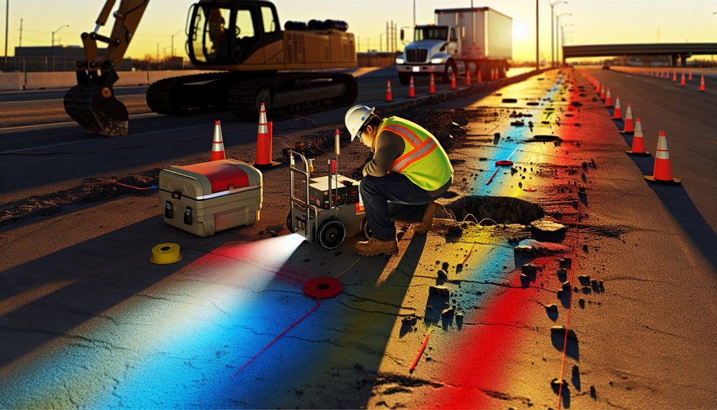
If you drill without mapping, you accept outages, injuries, and costly delays you could’ve avoided. GPR gives you calibrated, depth-aware profiles of both conductive and non-conductive utilities—plastic conduits, clay pipes, even abandoned lines—that EM locators miss. You get repeatable scans, defensible mark-outs, and fewer blind digs, which stabilizes schedules and change orders. The catch: GPR isn’t plug-and-play. To get reliable results, you need the right deployment, interpretation, and integration strategy—here’s where that starts.
The Risks of Drilling Blind: What’s at Stake

Before you put a bit in the ground, recognize that drilling blind can trigger utility strikes, service outages, injuries, and regulatory action. You accept more than schedule risk—you invite underground hazards that don’t forgive mistakes. A mislocated conduit can arc, flash, and incapacitate. A gas main rupture can ignite, evacuate blocks, and stall your project. Striking fiber cuts data to hospitals and clients, inviting claims and penalties.
You also face property damage, environmental releases, and expensive emergency digs. OSHA recordables rise, insurers scrutinize controls, and your client’s trust erodes. Crews feel it too—morale dips when avoidable incidents happen. You mitigate by validating records, marking tolerances, enforcing dig windows, and insisting on verifiable clearance. Tight controls protect people, budgets, and your reputation.
How Ground Penetrating Radar Works
Sweep the surface with a GPR antenna and you’ll transmit nanosecond radar pulses into the ground, then measure the echoes that return from changes in dielectric properties.
You read time-of-flight to estimate depth, and amplitude to judge dielectric contrast.
Strong reflections flag pipes, ducts, or voids; weak returns warn of signal attenuation from clays, salts, or saturated soils.
You control antenna frequency to balance depth and resolution, and you stack traces to boost signal-to-noise when conditions get noisy.
1) Choose frequency: lower for depth, higher for detail; match geology and target size.
2) Manage coupling: keep antenna close, steady, and aligned; minimize air gaps and wobble.
3) Validate reflections: track hyperbolas, migrate if needed, and cross-check anomalies.
This disciplined workflow keeps your crew aligned, confident, and out of harm’s way.
GPR vs. Traditional Utility Locating Methods

Why choose GPR when legacy locators already find many lines? Because induced-current tools rely on conductive targets and accessible trace points. GPR reads dielectric contrasts, so you see plastic, clay tile, and non-energized fiber you’d otherwise miss. You reduce blind spots, especially in mixed-utility corridors and complex Concrete slabmapping.
Traditional locators struggle with signal bleed, coupling errors, and congested rights-of-way. GPR delivers Non destructive verification with depth estimates and continuous profiles, not just a tone on a paint mark. You validate as-built records, reconcile conflicting marks, and catch abandoned lines before they become strike hazards.
In rebar-dense slabs and variable soils, tuned antennas and proper stacking mitigate noise. With trained interpretation, you tighten tolerances, document findings defensibly, and protect crews, schedules, and budgets.
When to Deploy GPR on Your Job Site
Even when plans look complete and locates are marked, deploy GPR any time excavation, coring, or saw-cutting risks striking unknowns or non-conductive utilities. You’ll protect people, schedule, and budget by scanning during site prep, before you mobilize heavy equipment, and whenever field conditions change.
Moisture, salinity, and fill layers shift quickly with seasonal timing, so update scans as soils freeze, thaw, or saturate.
Use GPR when drawings conflict, depth tolerances shrink, or you’re tying into legacy infrastructure. Bring it in when potholes can’t confirm lines or you suspect abandoned assets, plastic conduits, or fiber.
- Pre-mobilization: verify corridors and safe offsets.
- Change events: regrade, utilities added, or weather swings.
- High-risk activities: trenching near live lines, core drilling, slab saw-cuts.
Interpreting GPR Data: From Signals to Subsurface Maps

Although the screen shows colorful hyperbolas and reflections, interpreting GPR starts with physics, not pictures. You read contrasts in dielectric properties, then confirm them with disciplined Signal processing. First, clean the data: remove DC drift, apply time-zero correction, dewow, and bandpass to suppress site noise.
Next, migrate to collapse hyperbolas and anchor targets to true positions. Validate continuity across parallel lines; utilities behave coherently, debris doesn’t.
Depth conversion hinges on velocity. Don’t guess—estimate velocity from hyperbola fitting or common midpoint tests, then ground-truth with known depths. Update the model and rerun.
Map amplitudes, polarity, and geometry to classify pipes, ducts, and voids, and flag uncertainty zones. Deliver plan and profile maps with confidence bands, defensible notes, and clear “no-drill” buffers your crew can trust.
Choosing the Right Antenna Frequency for Depth and Resolution
When you pick a GPR antenna, you’re trading depth for resolution, and the wrong choice can miss a utility or misclassify a hazard. Use high frequency for shallow detail; choose low frequency for deep penetration. Soil conductivity, target size, and congestion dictate the sweet spot. You’re aiming for confident marks, not noisy guesses.
1) Urban streets: high frequency (900–1600 MHz) resolves dense, shallow services but fades quickly in wet clays.
2) Mixed corridors: mid-band (400–600 MHz) balances pipe identification and burial depth, keeping hyperbolas crisp to ~2–3 m in moderate soils.
3) Rural rights‑of‑way: low frequency (100–300 MHz) delivers deep penetration for larger utilities, accepting coarser resolution.
Validate by test lines, check signal-to-noise, and adjust time window. Document settings so your crew repeats success—and avoids repeat risk.
Integrating GPR With One-Call and As-Built Records

Before you roll a wheel, tie your GPR plan to the one-call ticket and the best available as-builts, then treat both as hypotheses to test, not truth.
Start with one call integration: import markout coordinates, utility owner notes, and expected depths into your layout. Overlay as-built alignments, noting dates and confidence levels. Then run systematic transects perpendicular to predicted routes, logging flags and anomalies with stationing.
Perform record reconciliation on the fly. When GPR hyperbolas deviate from mapped centerlines, adjust line spacing and verify with orthogonal passes. Tag each feature with source pedigree: GPR-confirmed, one-call only, or as-built only. Close gaps at crossings and terminations.
Hand off a composite map with traceable decisions, so your crew shares the same ground-truth picture.
Safety, Compliance, and Risk Mitigation Benefits
Even under tight schedules, GPR-driven utility mapping measurably reduces strike risk and strengthens your compliance posture. You validate subsurface conditions before drilling, document your due diligence, and give crews clear dig windows. Calibrated antennas, controlled grids, and repeat passes confirm depth and utility type, so you act on evidence, not guesswork.
1) Standardize worker training around GPR data: interpret hyperbolas, recognize interference, and apply hold points before coring.
2) Align procedures with regulatory updates: embed tolerance zones, documentation requirements, and change logs into your method statements and permits.
3) Close the loop on risk: run pre-task scans, hazard briefings with annotated maps, and post-scan signoffs to lock accountability.
You build a culture where safe locates are the norm, not exceptions—crew-ready, inspector-ready, audit-ready.
Cost Considerations and ROI for Contractors

Safer locates only matter if they pencil out, and GPR does. You control costs by preventing hits, delays, and rework. One avoided strike can cover months of rental or a lease payment. Factor in standby crews, idle rigs, claim deductibles, and schedule penalties—GPR trims each. It doesn’t replace 811; it closes gaps that cause overruns.
Model the full picture: equipment, training, data management, and periodic calibration as Lifecycle costs. Compare that to your historical cost of utility conflicts. Add the win rate boost when you bid with verified subsurface data. Owners notice.
ROI shows up in predictable days, cleaner change orders, and fewer incident reports. Standardizing GPR becomes a Competitive advantage: tighter estimates, faster approvals, and stronger client trust that keeps crews and calendars full.
Best Practices for Accurate Field Scanning and Mark-Outs
Although every site is different, accurate GPR mark-outs start with disciplined setup and controlled acquisition. You anchor results by running calibration routines at arrival and after any equipment change. Verify antenna coupling, time-zero, and depth scaling against a known target. Then make environmental adjustments: log soil moisture, surface material, temperature, and EMI sources. Choose antenna frequency to balance depth and resolution, and run orthogonal lines to confirm hyperbolas and continuity.
1) Plan the grid: define line spacing by target size, stake reference control, and set GNSS or total station ties for repeatability.
2) Execute passes: maintain constant speed, antenna height, and trace intervals; flag anomalies only after multi-pass confirmation.
3) Validate and mark: cross-check with records, pothole critical hits when feasible, paint depths with confidence codes and notes.
Conclusion
We don’t drill blind at Boring Bros — and neither should you. GPR gives us calibrated depths, finds both conductive and non-conductive lines, and creates defensible documentation we can stand behind. When we pair it with one-call, as-builts, trained techs, validated targets, and repeatable grids, we cut blind digs, stop costly change orders, and keep crews and schedules on track. If tolerances are tight, utilities are unknown, or plastic is likely, we deploy GPR every time — it’s practical risk control, compliance, and a measurable ROI. Want to learn more? Visit boringbro.com or call us at (954) 639-6167 — we’d love to help.